 |
|||||||||||||||||||||||
| Home | Site Map | About | News | Purchase | Products | Download | Support | Search | |||||||||||||||
|
|
|||||||||||||||||||||||
|
|||||||||||||||||||||||
| Home | Site Map | About | News | Purchase | Products | Download | Support | Search | |||||||||||||||
|
|
|||||||||||||||||||||||
Interpreting Your Data
Interpreting Information Imported as Contours
The two interpretation methods that suite information defined by contour maps are the Exact and Nearest Contour Methods.

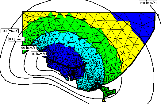
Using the Exact Interpretation method an evaluated point returns the value of the contour it lies in. Points which lie outside of all contours return the layer's default value. In the following screen shot the values at the mesh elements centers are evaluated with respect to the contour map presented, using the Exact Contour method.
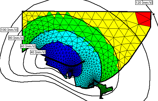
Using the Nearest Interpretation method an evaluated point returns the value of the contour it lies in or that of the contour nearest to it. In the following screen shot the values at the elements centers are evaluated with respect to the contour map presented, using the Exact Contour method.
Interpreting Covearge Information Imported as Contours
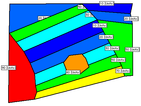
Contour maps or DXF files that describe coverage (i.e. vegetation type, permeability zones, etc.) can also be imported into Information layers and interpreted onto meshes and grids using the Exact and Nearest contour methods. The following is an Information layer describing a tesselated region using contours.
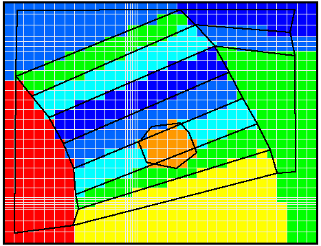
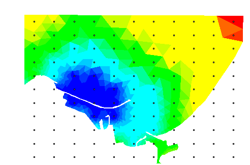
The following screen shot presents a grid evaluated with respect to the above coverage information using the Nearest Contour method.
Interpreting point wise Information
In many more instances, information is gathered and available at points. Argus ONE support importing of many types and formats of point wise information. Interpreting these types of information to mesh and grid objects is performed using the Interpolation method.
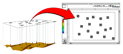
This captured screen presents how data on a grid is interpolated onto mesh elements. You can use Data, Infromation, Grid and Mesh layers to sample data and to upscale data onto your numerical grids and meshes.
To next page of introuction
To find out more about Argus and its products email marketing@argusone.com or call:
+972-9-957-5752
Tech. support: support@argusone.com
snail mail: Argus Holdings, POB 6254, Herzelia, 46160, Israel
Copyright © Argus Holdings, Ltd. 1992-2015