Argus Holdings
go to the Argus ONE home page Site Map of the Argus ONE site about Argus ONE news and announcements Prices, discounts and classrooms Short overview of Argus ONE Download Argus ONE, PIEs, documentation and tutorials All the Help you Need search the Argus ONE web site
 Home Site Map About News Purchase Products Download Support Search

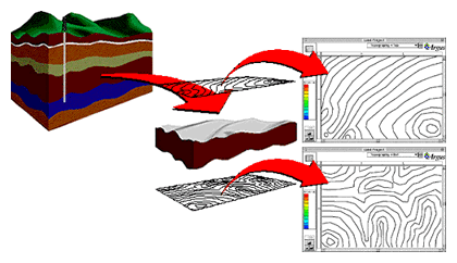
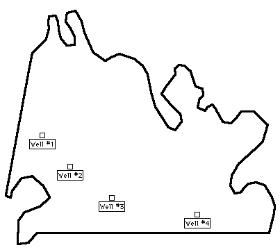
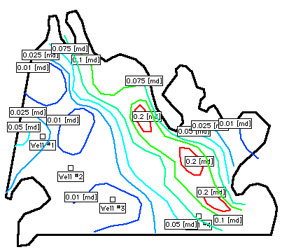
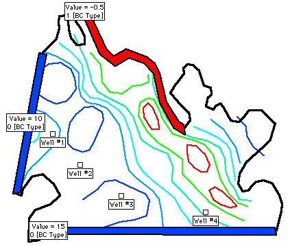
Graphically Define Your Problem Domain


Importing all relevant information into Argus Open Numerical Environment layers you can graphically define your problem domain. Using any number of information maps and data layers you can import and also draw on-screen the definition of your domain including its geometric shape as well as the distribution of boundary conditions. Adding topography, bathymetry, initial conditions and concentrations as well as materials spatial distribution you can fully define your problem domain.

The following illustration shows how contour maps of a geological formation's top and bottom elevations can be imported into Argus ONE information layers. If your information is available to you on data points you can import into data layers.

Illustration of translating topography information into MeshMaker layers

The following is a screen shot of a domain layer with a contour describing the domain outline and the locations of point sources/sinks. You can either digitize your domain's outline on-screen or import it from a file. The domain outline will allow your Argus MeshMaker modules to decide what is the domain to be meshed or grided and where to place special nodes.

Domain Outline image

Using additional information layers you can import or digitize the spatial distribution of a physical parameter or material properties. Argus ONE layers are transparent so that you can view your different data with respect to each other. Using layers hiding and showing allows you to fully control your view, as well as your printed reports.

The following screen capture shows a domain layer overlaid with an information layer describing permeability distribution.

Domain Outline and Information Contours image

Other information layers can serve to describe the distribution of boundary conditions, specify their types and values. In the following screen shot contours are used to mark boundary areas and the boundary condition type and value assigned to them.

If linked to mesh or grid layers (available with the Argus MeshMaker® Modules), nodes lying above these areas will be automatically assigned their proper boundary condition type and value.

Domain Outline, Information Contours and Boundary Conditions image

To next page of introduction


To find out more about Argus and its products email marketing@argusone.com or call:
+972-9-957-5752
Tech. support: support@argusone.com
snail mail: Argus Holdings, POB 6254, Herzelia, 46160, Israel
Copyright © Argus Holdings, Ltd. 1992-2015